- About – A little History
- How to visit
- Best Time To Visit
- Stay & Dine
- Top Things To Do & See In Yosemite National Park
- For 1 Day Itinerary
- For 2 Days Itinerary
- Additional Resources
About – A little History
Yosemite National Park is in California’s Sierra Nevada mountains. It is famous for giant, ancient sequoia trees, and for Tunnel View, the iconic vista of towering Bridalveil Fall and the granite cliffs of El Capitan and Half Dome. If you visit California, you should always make sure that Yosemite National Park is in your Itinerary.
We have been to Yosemite National Park couples of times and there are still so many places we have not been able to visit in the Park. There are plenty of things to do and see in Yosemite and since it’s one of the most popular tourist attractions within California, you need to make sure you plan well in advance and make advance reservations.
Based on our Itinerary, we have gathered our top favorite things to do in Yosemite and we hope this list helps you to plan your visit to the park. Before you plan your trip, make sure you have all the information you will need. We visited the park in both winter and summer and we loved it both the times.
Before visiting the park, we recommend checking the current weather conditions on the nps website: https://www.nps.gov/yose/planyourvisit/conditions.htm
Note: There are only 2 gas stations in the park and no gas in yosemite valley. To speak to the ranger in the park, you can call park number and select option to speak to ranger at the prompt: 209/372-0200
Visitor Centers
Yosemite National Park has 5 visitor centers. Yosemite Valley visitor center, Big Oak Flat Information Center, Wawona information Center, Yosemite Conservation and Heritage Center, Tuolumne Meadows Visitor Center.
Yosemite Valley Visitor Center: The Valley Visitor Center is open year round and offers natural history displays, audiovisual programs and is staffed with individuals who are happy to answer all your questions. Physical Address: 9035 Village Dr, Yosemite National Park, CA 95389-9912
Big Oak Flat Information Center: This visitor center is located on Big Oak Flat Road and the Big Oak Flat Information Station has knowledgeable National Park Service Rangers and Yosemite Association staff on hand to answer any questions you may have. You can also get maps, books and wilderness permits here. This is open only in summer.
Wawona Information Center: Located at Hill’s Studio near the Wawona Hotel and the Pioneer Yosemite History Center in Wawona. Open only in summer May to October. Physical Address: 8308 Wawona Rd, Wawona, CA 95389.
Yosemite Conservation and Heritage Center: Formerly called as LeConte Memorial Lodge (Open late May to early September) is Yosemite’s first public visitor center, operated by the Sierra Club, features a children’s corner, library, and a variety of environmental education and evening programs. Physical Address: 9006 Southside Dr, Yosemite Valley, CA 95389.
Tuolumne Meadows Visitor Center: Only open in the summer, this Visitor Center has exhibits that feature information on area geology, wildflowers, ecology, bears and other wildlife, the human history of the area and wilderness etiquette. Physical Address: Tioga Pass Rd, Yosemite Valley, CA 95389.
How to get here
With just little planning, it is very easy to get to Yosemite National Park from anywhere in the world. If you are in California, the best way to visit the park is by renting a car.
By Car
You can easily drive to Yosemite National Park and the park is about 4 hours drive from San Francisco and you will have to pay visitor fees of 30$ (USD) in Summer and 25$ (USD) in winter. From SFO (San Francisco International Airport), the park is about 2 ½ hours to Big Oak Flat entrance via Highway CA 120, 3 ½ hours to heart of Yosemite Valley. 4-5 hours to Tuolumne Meadows. Highway CA-120 is via Tioga Road (A beautiful Scenic drive) is open during Summer and Fall and closes during Winter depending on the weather conditions. There is a free parking within the park but the parking spots are very limited so plan accordingly.
During peak season (May 20 – September 30) and peak hour reservations (6AM – 4PM PST), you will also need to make advanced entry reservations to visit the park. If you are visiting the park after 4PM PST, you do not need entry reservations. However if you have any lodging reservation within the park or Camping reservation, you do not need additional entry reservation. For more information check website https://www.nps.gov/yose/index.htm.
By Plane
You can fly to SFO (San Francisco International Airport) and then rent a car and drive 2 ½ hours to Big Oak Flat entrance via Highway CA 120, 3 ½ hours to heart of Yosemite Valley. From Mammoth Yosemite Airport (MMH), you will need to drive 2½ hours to Yosemite Valley via Highway CA 395 and Highway CA 120 Tioga Rd.
By Train & Bus
AMTRAK train serves main cities like San Francisco, Los Angeles, Fresno, San Jose and San Diego to and from the Merced and then take YARTS (Yosemite Area Regional Transportation System) bus lines to get directly to the Yosemite Valley. For more information visit http://www.amtrak.com/
Shuttle Information

Yosemite Bus Shuttle (Photo: NPS Yosemite Bus Schedule)
How many days do you need
We always have this confusion as to how many days do we need to cover popular attractions in the park? The answer to this question depends on what you want to see. We personally recommend two days if you are planning to visit top attractions and do popular hikes.
Check our 1 Day and 2 Days Itinerary
Best Time To Visit
The best time to visit Yosemite National Park is during the months of March & April and again during the months of October & November. These two windows of time will give you the best combination of smaller crowds and pleasant weather.
May and October attracts more than 75% of the park’s annual visitors, you can get a much quieter, calmer and crowd-free experience outside of these months. As of 2024, there is a online reservation system to visit Yosemite National Park. For more information, on this check the Entry Reservations on NPS website.
Where to eat & stay
Yosemite Hospitality manages the lodging options inside the park. You have cabins at High Sierra Camps to the deluxe rooms at Ahwahnee. Reservations are available 366 days in advance. Average rates are from 260 upto 600$ per night with Curry Village having price in the mid 250s.
If you cannot find accomodation inside the park, you can consider staying in private lodging. For more information, visit https://www.nps.gov/yose/planyourvisit/eatingsleeping.htm.
There are also tons of campgrounds within the park and reservations are required starting from April through October.
Reservations. to the campgrounds are extremely difficult to get. Camprgound reservations open 5 months in advance and they open on the 15th of each month. Note: You will need to be online at 7am PST on the 15th of each month and 5 months in advance to make you reservation through recreation.gov. For eg: on January 15, arrival dates for the period May 15 to June 14 become available to reserve, and therefore, the full arrival date window would be from the campground open date to June 14.
For more information on the campground, visit https://www.nps.gov/yose/planyourvisit/campgrounds.htm
After trying back to back for two years, we were finally able to get campground reservation at Upper Pines Campground which is one of the popular campground and largest of the three reservation campgrounds in Yosemite Valley. It offers paved roads and parking spurs, flush toilets, and drinking water. Each campsite contains a picnic table, fire ring, and a food storage locker.
Important: If you don’t have either Campground. or Lodging reservation, you can stay outside the park. The closest town to Yosemite is El Portal which is around 14 miles west of Yosemite Valley. Hotels In El Portal CA
For Dining, there are plenty of options in the park and range from groceries to pizza to a fine dining experience at The Ahwahnee. Dining reservations are also available 366 days in advance for The Ahwahnee Dining Room, the Mountain Room, Tuolumne Meadows Lodge, and White Wolf Lodge and are recommended, especially from spring through fall and during holidays.
We had our dinner at the Base Camp Eatery and the food was good. They are open daily 5 – 10 PM. Dinner are usually served till 9 PM. Base Camp Eatery is a year-round food court at the Yosemite Valley Lodge.
Our personal favorite dining places are Loft at Degnan’s, Degnan’s Bakery, Village Grill and the Meadow Grill. There are food options in Yosemite Valley Lodge and Curry Village.
Note: Due to high popularity, lodging options inside the park are expensive and need advanced reservations.
Wildlife In Yosemite National Park
Yosemite National Park is home to approximately 90 mammal species (including Black Bears) and 262 species of birds, 22 species of reptiles and other animals. For more information on the animals, visit https://www.nps.gov/yose/learn/nature/animals.htm
Top Attractions In Yosemite
- Yosemite Valley
- Upper and Lower Yosemite Falls
- BridalVeil Falls
- Vernal Falls & Nevada Falls
- Mirror Lake
- Tunnel View
- Cooks Meadow Loop
- Glacier Point
- Hetch Hetchy
- Mariposa Grove and Wawona
- Tuolumne Meadows and Tioga Road
- Half Dome
- El Capitan
- The Ahwahnee
Yosemite Valley
Yosemite Village can be the very first stop in the park and is known for its towering granite falls and features like El Capitan and Half Dome. The best time to visit this valley in in spring and early summer with numerous roaring waterfalls. You can choose from number of scenic trails to walk, hike or even bike. Other popular activities include rock climbing and rafting.
Our best activity is always hiking in the park and we feel this is the best way to explore the park. Important Note: If you are planning to arrive by car, be here before 9AM PST since the parking is usually mostly full by 9AM. Parking is available at Yosemite Village, Curry Village, and near Yosemite Falls. If you find a parking space, please plan to leave your car there; you will not be able to find another parking spot. We moved our car and had very hard time finding another parking spot.

Valley Chapel during winter
Upper and lower Yosemite Falls
If you have a day, you can definitely add lower yosemite falls to your trip. Lower yosemite falls is (1.1 miles) loop trail. You can start from the lower yosemite falls trailhead and also take shuttle and get down at stop #6 to hike lower yosemite falls.
Upper Yosemite Falls: (7.6 miles Round Trip) Upper yosemite falls is 7.6 miles round trip from lower yosemite falls. The hike is strenuous and will require at least 5-6 hours for average hiker. If you just have a day we recommend you skip this hike and just do the lower yosemite falls like we did.

Lower Yosemite Falls Trailhead

Falls Seasonal Flow
Bridalveil Falls
Bridalveil falls hike is 0.4 miles out and back. This is a popular waterfall in the park which plunges from a height of 620 feet and flows all year with peak flow in May. This is often the first waterfall you will see when entering Yosemite Valley. You will see a paved trail which leads from the Bridalveil parking area to the base of the waterfall.
Although the trail has been closed since February 2021 due to rehabilitation project, you can still see the falls from near the tunnels on the Wawona Road (Highway 41) or Big Oak Flat Road (Highway 120) and from a signed parking lot on your way into Yosemite Valley.
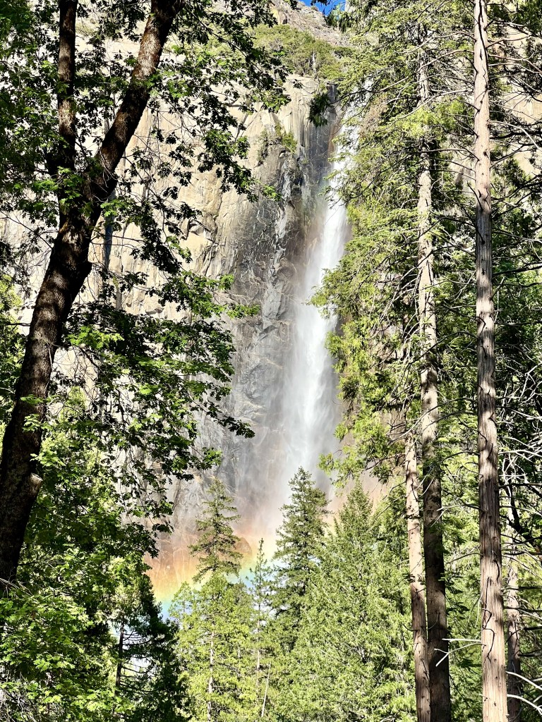
BridalVeil Falls
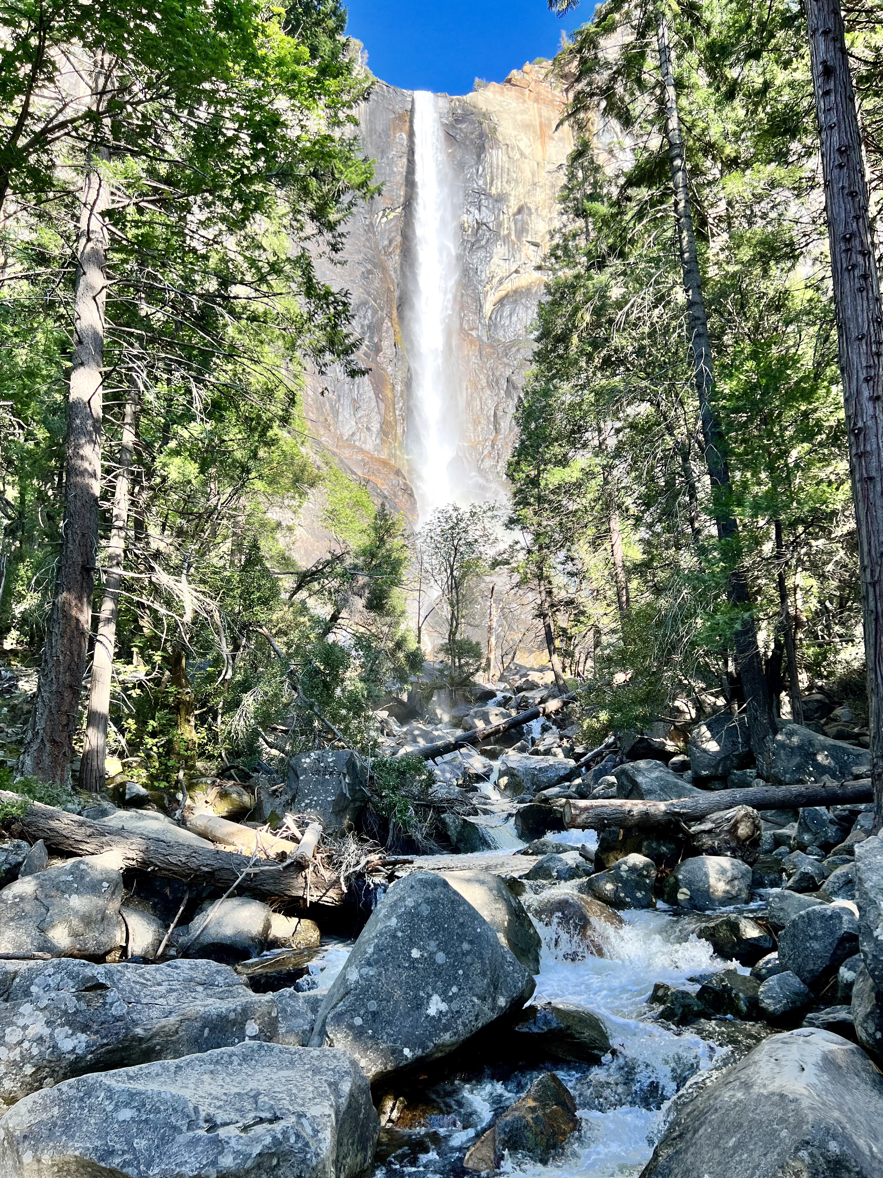
Bridalveil Falls Closer View
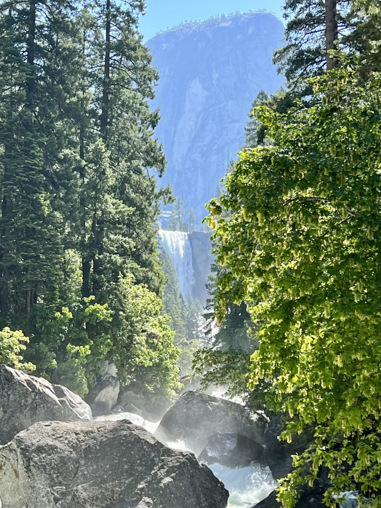
Vernal Falls & Nevada Falls
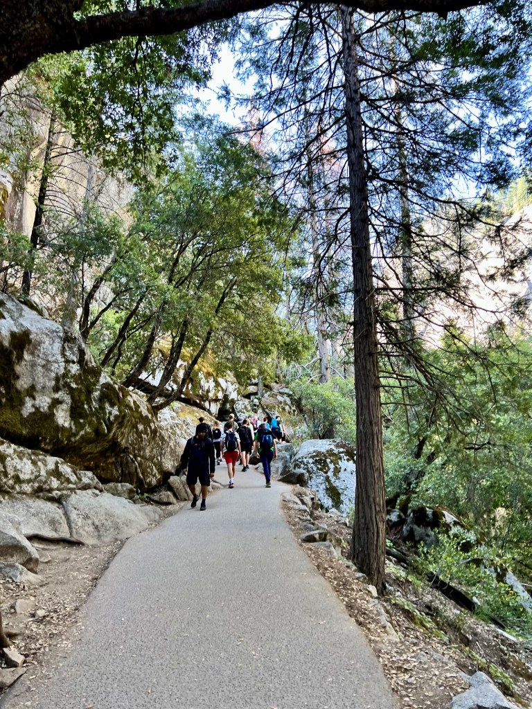
Your trail to vernal and nevada falls begins at the Mist trail which begins at the east end of Yosemite Valley by the Happy Isle Nature. You can reach the trailhead by shuttle stop 16. There is a valley parking lot less than half a mile from the trailhead and this is the nearest parking lot to the trailhead. (Note: It can be too crowded during the peak months and weekends. We recommend you reach here early.) You can also park at the curry village parking lot as well but this will add to 0.8 miles to the trailhead.
Note: If you dont wish to have the hassle of parking, we recommend you take the shuttle which stops at the Happy Isles Stop (#16) and hike from there.
Top of Vernal Falls (2.4 miles) round trip. (Approx 3 hours)
Top of Nevada Falls (5.4 miles) round trip. (Approx 5 – 6 hours)
Directions:
- From the shuttle stop 16, you will continue on the Happy Isles Loop Road and then you will see a Mist Trail sign which confirms you that you are in the right direction. Hiking down this path, you will reach Happy Isles Bridge.
- Once you are over the bridge, make right turn onto the Mist Trail. You will see a small diversion and directions to the vernal falls and nevada falls. You will need to turn left near the diversion and continue to reach the Vernal Falls Footbridge. From the Footbridge, you will have a straight on amazing view of Vernal Falls. If you do not have much time, you can decide to turn around or continue. (Note: There are bathrooms and water refill stations near the vernal falls footbridge)
- If you continue over the bridge, you will come across an intersection with the John Muir Trail to the right. This is actually the official start of the of the Mist Trail. You will see a cool Mist Trail sign right after the junction.
- To hike directly to the top of Vernal Falls, follow the Mist Trail (0.5 miles) up a steep granite stairway. You will be climbing 600 wet granite steps to get to the top of Vernal Falls. By this time you will have a amazing view of the falls and its mist all over your face. You will see narrow sections offering handrails and continue further. Last few sections of the hike to Vernal falls include granite cliffs and narrow stretch to the top. Once you are done with this section, you will soon emerge slightly above Vernal Falls. You can huke down the hills to to get to the edge of Vernal Falls. (Honestly: This was the most amazing view of Vernal Falls and all the effort was well worth it!!)
- You can continue towards Nevada Falls from here or turn around to go back in the same direction. We actually continued till we got the close view of Nevada Falls and turned back the same way we came since we were short of time. If you are up for it, I would definitely recommend you do the Nevada Falls hike as well.
Nevada Falls Directions:
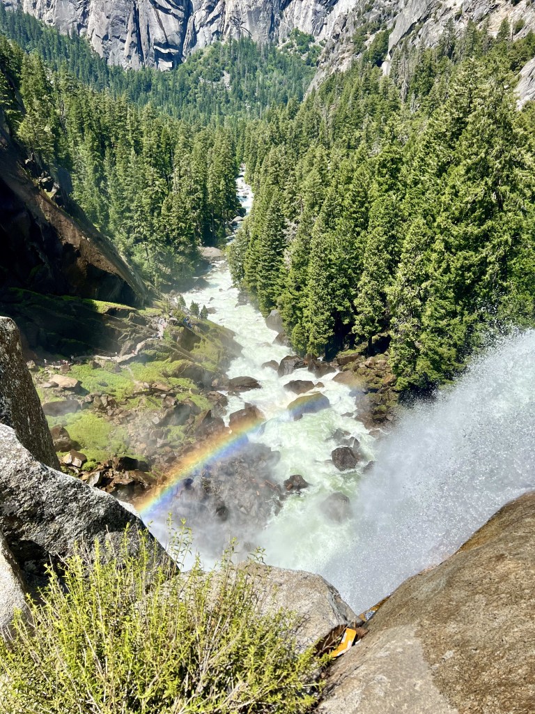
- You continue further from the Vernal Falls viewpoint, you will see Emerald Pool on the left along with Mist trail with Mount Broderick in the distance. You will also find a silver apron along the trail where you can relax and enjoy the view.
- Once you reach the silver apron area, you would have hiked well more than 2 miles. There are restrooms here and you can also stop for a snack as there. are many shaded areas nearby to rest.
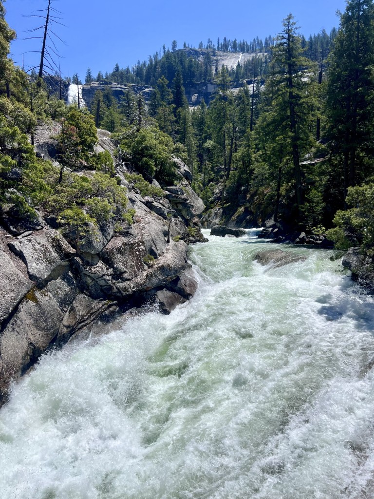
- From the silver apron area, you will be able to see the footbridge with Liberty Cap and Nevada Falls in the distance. We continued our hike along this area to reach to the base of Nevada Falls. Since we didn’t have time, we just relaxed at the base of Nevada Falls and turned around in the same direction we came to end out day’s hike to Vernal and Nevada Falls.
- If you still like to continue further from here, you can hike for another 3 miles and with nearly 2000 feet in elevation gain, you should be able to get to the incredible view at the top of Nevada Falls.
Note: Please respect the warning signs along the hike and stay out of water above the falls. We often saw people not respecting the warning signs and trying to get close to the water above the falls. These are strong currents so please refrain yourself from getting too close to the water above the falls and near emerald lake and silver apron area.
Going to the Mist Trail
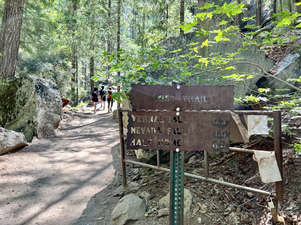
Mist Trail Sign
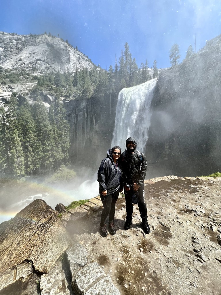
Vernal Falls
Top of Vernal Falls
Merced River

Base of Nevada Falls
Mirror Lake
Trail Overview:
Total Distance: 2 miles (3.2 km) round trip to lake and back.
Elevation: 100 feet
Difficulty: Easy to Moderate
Time Needed: 1 – 2 hrs on an average
Shuttle Stop: #17
Note: There is no parking at the trailhead. Nearest parking area is at Curry Village. Best option is taking free shuttle and get off at the stop 17. East Valley Shuttles run from 7am – 10pm.

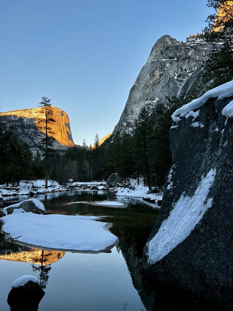
Mirror Lake during winter
Directions:
- You will begin at Mirror Lake trailhead. First mile of the trail is paved service road leading directly to Mirror lake. This loop follows Tenaya Creek beyond the lake, and crosses two bridges after the Snow creek trail junction before returning on the other side of Mirror Lake.
- The directions are clearly marked and if you plan on making the full loop around the lake, it takes about 2-3 hours.
Mirror Lake is pleasant any time of the year but its at the fullest during spring and early summer. We hiked Mirror Lake right after the fresh snow melt time and the view was wonderful.
Tunnel View
If you want to have famous views of Yosemite Valley with a classic view of El Capitan, Half Dome, Sentinel Rock, Cathedral Rocks and Bridalveil Falls, you have to stop at the Tunnel View. This place is picture perfect during Sunset which is why you will need to arrive here early to find parking. First time we went, we couldn’t get a clear view due to the fog.
Where: Its located at the east end of the Wawona Tunnel along the Wawona Road on Highway 41 and open year round. If you are coming from the south, you can take the CA-41 N and take exit into Wawona Road to get to the tunnel.
History: Construction of the Wawona Tunnel began on January 30, 1931 and was opened to public on June 18, 1933.
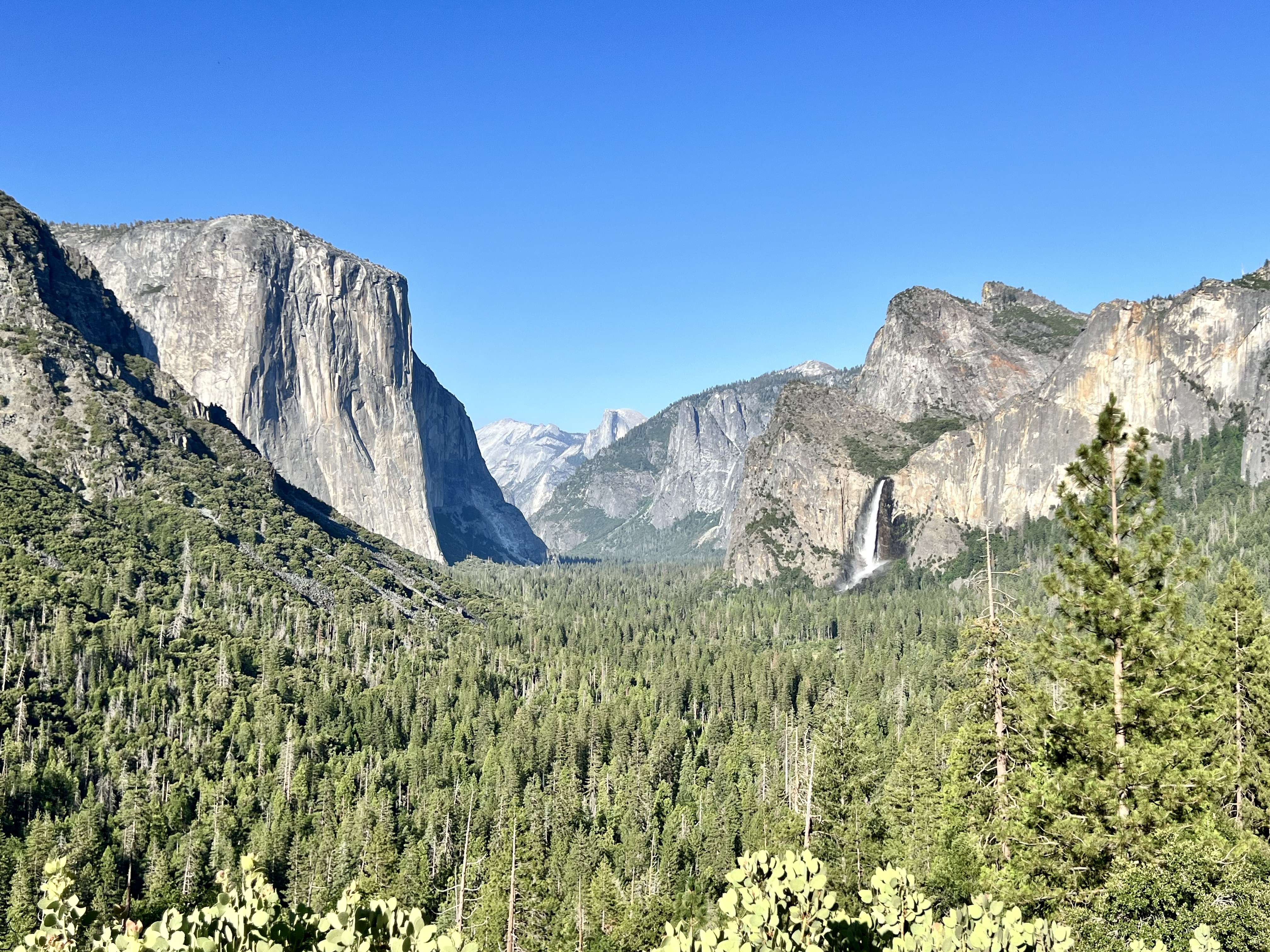
Tunnel View With BridalVeil Falls In the Distance
Cooks Meadow Loop
If you have a day, I would recommend doing this easy 1 mile round trip hike. This short easy walk offers stunning views of the Yosemite Falls, Glacier Point, Sentinel rock and Half Dome.
How to get here: You can take shuttle and get down at the Yosemite Valley Visitor Center (Shuttle stop #5) or get down at Lower Yosemite Fall Trailhead (Shuttle stop #6). If you decide to drive, nearest parking is at the Yosemite Village and Yosemite Falls Parking Area.
Glacier Point
Although we didn’t do this overlook, we would like to give some information about this as this is one of the popular viewpoint in Yosemite. Its an overlook with commanding view of Yosemite Valley, Half Dome, Yosemite Falls, and Yosemite’s high country.
Total hike is 0.6 miles loop trail near Yosemite Valley, California. Generally considered a moderately challenging route, it takes an average of 20 mins to complete.
Accessible by car from approximately late May through October or November. If you are coming in winter (December – March), you can skii 10.5 miles to get to this point.
How to get there:
You can either drive or take a bus. The Glacier Point Road is open to cars approximately late May through October or November, depending on conditions. You can drive to Glacier Point by traveling on the Wawona Road either north from Wawona or south from Yosemite Valley. After traveling about 13 miles, turn on to the Glacier Point Road at the Chinquapin intersection.
You can also take the Glacier point tour bus which generally operates when the Glacier Point Road is open. One-way tickets are available if you’re interested in taking the bus to Glacier Point and hiking back to Yosemite Valley.
As f 2023, Glacier point tours were not operating. Please check website for more up to date information.

Glacier Point (Photo: NPS)
Hetch Hetchy
Hetch hetchy is a valley, reservoir and a water system in California and lies in the northwestern part of Yosemite National Park. This reservoir is one of the top attractions in Yosemite.
The road to Hetch Hetchy is open only during daylight hours. When the road is closed, there is no access to Hetch Hetchy trailheads. Below are the hours of when the road to Hetch Hetchy is open.
April 1 to April 30: 8 am to 7 pm
May 1 to Labor Day: 7 am to 9 pm
Day after Labor Day to October 31: 8 am to 7 pm
November 1 to March 31: 8 am to 5 pm
How to get here: It is located 38 miles from Yosemite Valley and the road to Hetch Hetchy begins just outside the park on the Highway 120, near the Big Oak Float Entrance.
There are plenty of day hikes in hetch hetchy. For more information, refer https://www.nps.gov/yose/planyourvisit/hetchhetchy.htm
Note: You can access this area only by car as there is no public transportation. Also note that vehicles and or trailers over 25 feet long and 8 feet wide are not permitted.
Mariposa Grove and Wawona
If you are interested in giant sequoia trees, you will need to visit Mariposa Grove. You can park at the Mariposa grove welcome plaza near south entrance or take a shuttle up to the grove or hike the 2 mile washburn trail.
If you are interested in short hike, you can do the Big Trees Loop Trail which is 0.3 miles loop from trailhead and takes about 30 – 45 mins to complete.
For more things to do in Mariposa Grove, refer: https://www.nps.gov/yose/planyourvisit/mg.htm
Directions: From the valley, you can take Wawona Road (highway 41) and watch for signs to take turn at Mariposa Grove before the South Entrance.
Note: Parking is very limited at the welcome plaza. You will need to arrive by mid-morning to increase your chances of getting a place to park.
Shuttle Hours for 2023 were as below: (Source: NPS)
- April 14 through June 8: No shuttle service due to road damage.
- June 9 through September 7: 8 am to 7 pm (last bus leaves Mariposa Grove at 8 pm). Buses pick up about every 10 minutes.
- September 8 through November 7: 8 am to 5:30 pm (last bus leaves Mariposa Grove at 6:30 pm). Buses pick up about every 15 minutes.
- November 8 through November 30: Weather permitting, 8 am to 3:30 pm (last bus leaves Mariposa Grove at 5:00 pm). Buses pick up about every 15 minutes.
- December 1 through March 30: No shuttle service available.

Giant Sequoias of Mariposa (Photo: NPS)
Tuolumne Meadows and Tioga Road
A large, open subalpine meadow graced by winding Tuolumne river and surrounded by majestic peaks and domes.
How do you get here: From the valley, you can take the highway 120 for ten miles to the Crane Flat turnoff into Tioga Road and then through Tioga Road, travel 38 miles east to reach the Meadows. If you are at the east entrance, you can take the Tioga Road west 8 miles to reach. the meadows.
If you are coming by bus, you can take YARTS which provides public transportation to the meadows in the summer. Shuttle service is also available in the area. You can also take the guided bus tours. In winter, you can ski to the area.
There are plenty of things to do in Tuolumne meadows area. If you are interested in short hike, you can do the Soda Springs and Parsons Lodge easy hike which is about 1.5 miles round trip and takes about one hour. Your hike will begin at Lembert Dome Parking Area (shuttle stop #4) and walk along gravel road and passed locked gate area to reach Soda Springs. Soda Springs are carbonated, cold water bubbling out of the ground. Continuing along the gravel road, you can reach historic Parsons Memorial Lodge and the Tuolumne Meadows Visitor Center.
There are plenty of day hikes in Tuolumne Meadows. For more information, refer https://www.nps.gov/yose/planyourvisit/tmhikes.htm
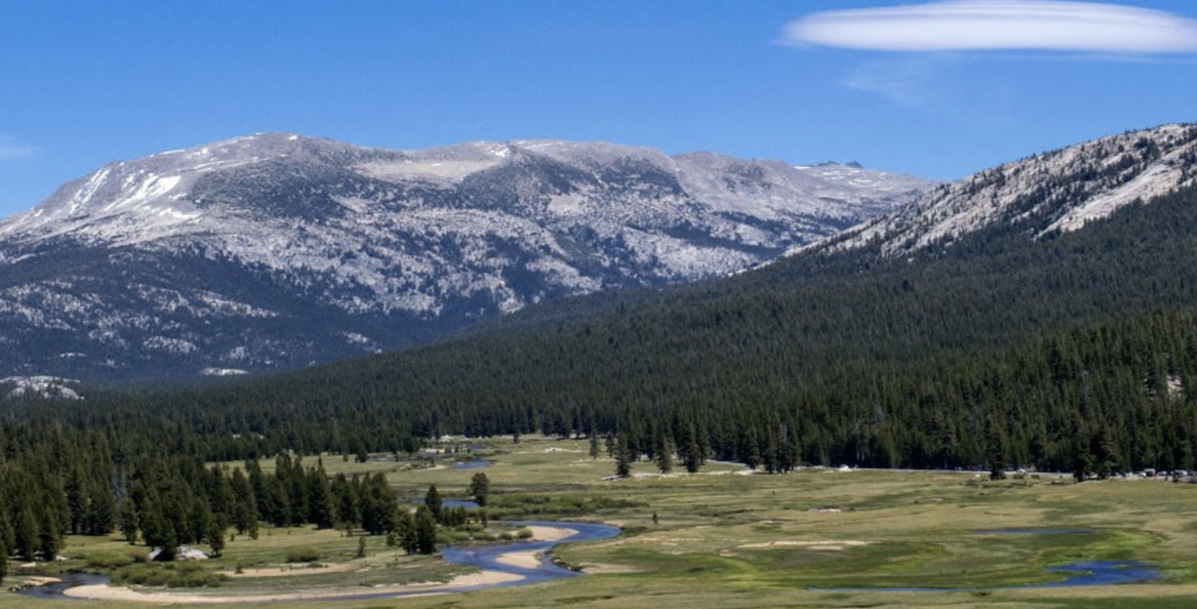
Tuolumne Meadows (Photo: NPS)
El Capitan
El Capitan, rising over 3,000 feet above the floor of Yosemite Valley, is a favorite for experienced rock climbers and onlookers alike. El Capitan is best seen from El Capitan Meadow. From spring to fall, climbers come from all over the globe to scale El Capitan and discover the thrill of the vertical wilderness on Yosemite’s big walls. El Capitan Meadow also provides a great view of Lower and Middle Cathedral Rock, and the Cathedral Spires, which loom over the meadow.
How to get here: By driving towards Yosemite Valley on Highway 41 and parking right after you come through the Wawona Tunnel.
Note: If you like to get to the El Capitan meadow, remember there are limited parking pull outs along this stretch of road.
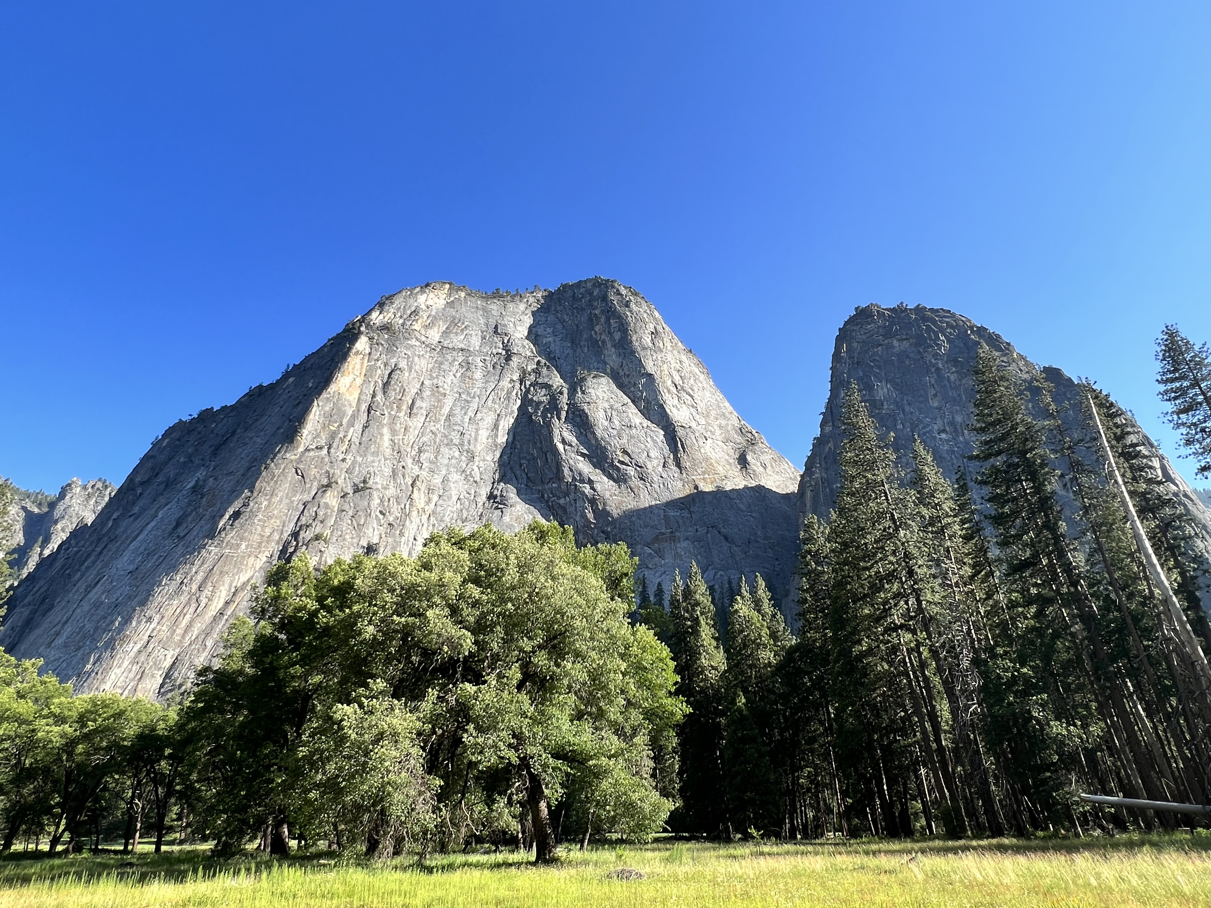
El Capitan
Half Dome
Distance: Close to 17 miles round trip
Total Ascent: 5,457 Feet
Difficulty: Extremely strenuous
Length of Time: 10 – 14 hours
Permits: You must have a permit to to climb the Half Dome cables. (This portion of the hike is the most popular one)
Half Dome is a yosemite icon a great challenge to hike even for professional hikers. Half Dome stands at 5,000 feet above Yosemite Valley and 8,800 feet above sea level.
How to do the hiking: The total hike to half dome is 14- to 16-mile round-trip. The elevation is about 4,800 feet most of your way to the top of Half Dome. In order to hike half dome, you will have to cross the outstanding views of Vernal and Nevada Falls, Liberty Cap, Half Dome, and–from the shoulder and summit–panoramic views of Yosemite Valley and the High Sierra.
The most famous part of the hike is the ascent up the cables. The two metal cables allow hikers to climb the last 400 feet to the summit without rock climbing equipment. Since 1919, relatively few people have fallen and died on the cables.
Half dome cables are usually up from Memorial Day through Columbus Day.
Although we didn’t do this hike due to time constraints, we would like to give as much information as possible so that you can plan this in your schedule based on your hiking interests. We definitely plan to do this in the future.
Average Time: Most of the hikers take 10 to 12 hours to hike to Half Dome and back and some take even longer.
Important: You will need permit to hike Half Dome and getting permit is not easy since the half dome hike is very popular in the park. In order to get the permit, you will need to apply for permit on recreation.gov and permits are issued based on lottery basis. There are two types of lottery systems Preseason Lottery and Daily Lottery. Application fees for the lottery are 10$ which is non-refundable fee and another 10$ you will pay once you get the permit. Application period for the lottery is March 1 through March 31 and the results are announced mid-april.
NOTE: More details on how. to apply permit is on the nps website and to apply on recreation. gov visit the website.
Note: You have to start this hike very early in the morning so that you give sufficient time to hike to the top of the Half Dome and hike back. If you haven’t reached the top of Half Dome by 3:30 pm PST, you will need to think about turning back. Else you will not have sufficient time to hike back before sunset. Hiking in the dark is extremely dangerous. You should never attempt the cables ascent if the storm clouds are in the area or if the ground is wet. You should never attempt this hike if you have altitude sickness.
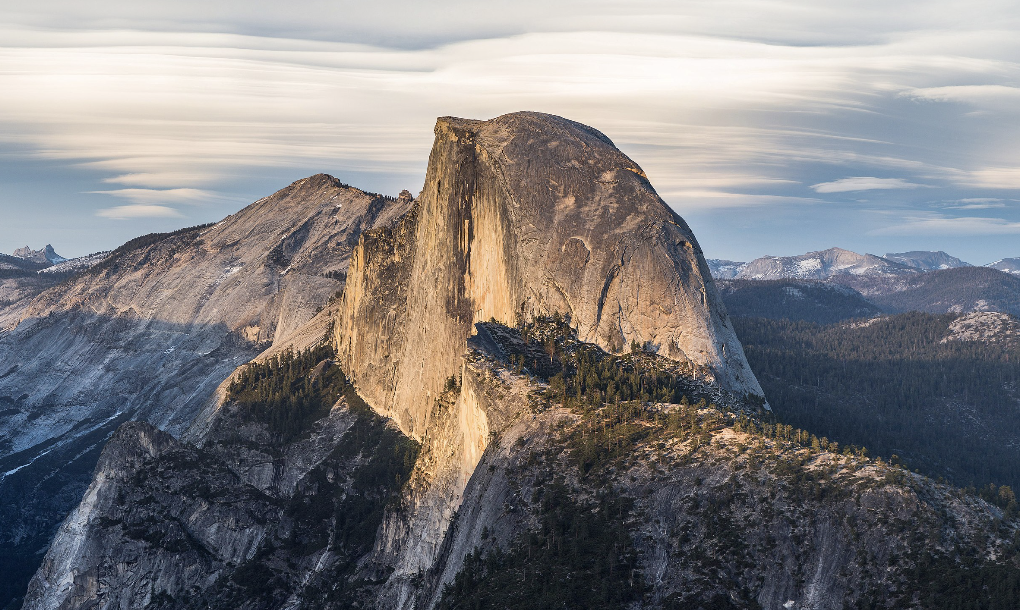
Half Dome (Photo: Wikipedia)
Ahwahnee
One of the top lodges in the park, and known for its stunning interior design and architecture, The Ahwahnee was specifically designed to highlight its natural surroundings, featuring Yosemite Falls, Half Dome, and Glacier Point. Considered as one of the top attractions, even if you are not staying in the hotel, you should at least check out the architecture and interior design.
The Ahwahnee offers hotel rooms, suites, cottages, gift shops, parlors, sweet shop, a bar, and a heated outdoor swimming pool. In the dining room, guests can have breakfast, lunch and dinner.
Open year round, with front desk staff ed 24 hrs a day. Check in time is 4PM and Checout Out time 11 am.
How to get to the hotel: You can reach Yosemite Valley via Highways 41, 140, and 120. Follow signs for The Ahwahnee, located in eastern Yosemite Valley. Parking is valet only. You can also take a valley wide shuttle and get down at shuttle stop #3.
NOTE: You might not be able to visit Dining room as they have temporarily closed until further notice. When we went it was closed for fall 2023.

The Ahwahnee (Photo: NPS)
For 1 Day Itinerary
- Visit Yosemite Village
- Upper & Lower Yosemite Falls
- BridalVeil Falls
- El Capitan Meadow & Picnic Area
- Hop On the Park Shuttle
- Tunnel View
- Take a dip in merced river
- Visit Curry Village
- Visit Ahwahnee
For 2 Days Itinerary
- Do all from 1 Day Itinerary
- Hike Vernal & Nevada Falls
- Visit Mariposa Grove and Wawona/ Cooks Meadow Loop
- Visit Hetch Hetchy Reservoir
Additional Resources
For complete list of Yosemite Essentials, Hiking, esential services, Shuttle services, you can download the pdf copy from the NPS website: https://www.nps.gov/yose/planyourvisit/upload/Volume-48-8-508V1.pdf
For other popular things to do in the park, visit the NPS wesbite: https://www.nps.gov/yose/planyourvisit/things2do.htm.
For complete inforamtion on the hours of operations, visit https://www.nps.gov/yose/planyourvisit/basicinfo.htm
